
Hiking Sunday Gulch · South Dakota Weekend travel plan
Moderate to Strenuous · About 3.9 to 4.0 miles loop
Trail at a glance
Moderate to Strenuous · About 3.9 to 4.0 miles loop
Custer State Park, South Dakota
Orientation only—not to scale or for navigation. Follow the official map and signs; closures override this schematic.
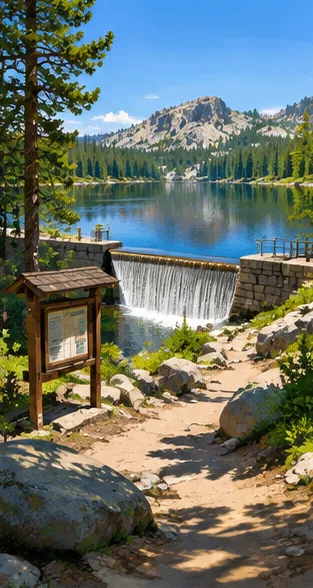
Start at the official trailhead and follow the signed route on the park map: Approximately 3.9 to 4.0 miles loop; Moderate to Strenuous descending steeply behind Sylvan Lake Dam through a narrow granite canyon using metal handrails, boulders, and stream stepping stones. Turn back at a marked junction if weather, footing or daylight change; never shortcut off trail.
Leashed dogs are permitted, though slick boulders and metal handrails near the dam can be tricky for smaller dogs. Check official alerts, closures, fees and campground reservations before you go; route distances vary with the chosen combination.
Where to stay
Hotel ideas for each city along your route. Price tiers are relative; check your dates, room type, location and current availability before booking.
Both nights · one overnight baseSunday Gulch gateway
These are suggested bases, not guaranteed rates or walking-distance hotels. Check the drive to Custer State Park, South Dakota, availability and seasonal operation. Leashed dogs are permitted, though slick boulders and metal handrails near the dam can be tricky for smaller dogs. Check official alerts, closures, fees and campground reservations before you go; route distances vary with the chosen combination.
- Iconic · $$$$
EO Bungalows
Landmark & luxury hotels · South Dakota · verify drive, rates and facilities
Grand hotels & distinctive stays
- Boutique · $$$
Super 8 Custer
Characterful small hotels · South Dakota · verify drive, rates and facilities
Design & local charm
- Smart value · $
Bavarian Inn, Black Hills
Budget-friendly stays · South Dakota · verify drive, rates and facilities
Lower-price hotel options
Camping & campsites
Sylvan Lake Campground
Separate camping option for this hiking weekend; check exact location, drive or hike-in access, facilities and pet rules. Leashed dogs are permitted, though slick boulders and metal handrails near the dam can be tricky for smaller dogs. Check official alerts, closures, fees and campground reservations before you go; route distances vary with the chosen combination.
Check official opening dates, permits, reservations and availability; never assume a site is guaranteed.
Official camping details
- Day 2 · Gentle trails & local discoveries
You might also like
- Hiking Sugarloaf Mountain · Maryland WeekendModerate; steep summit options · Choose a 2–5 mile marked loop

- Hiking Cascade Falls · Maryland WeekendModerate · 2–3 miles with woodland extensions

- Hiking Annapolis Rock & Black Rock Cliff · Maryland WeekendModerate · 5.3 miles to Annapolis Rock; about 7.3 with Black Rock

Stories and advice for United States
Loading stories and advice…